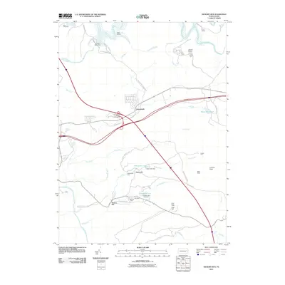
2010 Map of Hickory Run
USGS Topo · Published 2010About this map
Hickory Run State Park dominates this modern landscape, preserving a network of mountain streams and geological formations in Carbon County. The hydrology of the area is defined by the Lehigh River and the massive Francis E Walter Dam, which creates the F. E. Walter Reservoir to the north. Small settlements and camps like Leonardsville, Saylorsville, and Camp Acahela are interspersed among the ridges, while the Jack Frost Mountain Ski Area indicates the region's development as a recreation hub. A notable natural feature is the Boulder Field, a National Natural Landmark situated east of Hickory Run. The map also details numerous small-scale water controls, such as the Stametz Dam and CCC Dam, alongside newer infrastructure like the Pennsylvania Turnpike Interchange 35.
Find a feature on this map
44 named features on this map. Tap any name to fly to it.
Don’t see what you’re looking for? This feature index may not catch every label — zoom into the map to look around manually.
Map Details
Editions of this 2010 Hickory Run Map
This is the sole edition of this map. No revisions or reprints were ever made.
Other maps of this area

1889 · Hazleton
USGS Topo · 1:62,500

1891 · Wilkesbarre
USGS Topo · 1:62,500

1891 · Hazleton
USGS Topo · 1:62,500

1893 · Hazleton
USGS Topo · 1:62,500

1894 · Wilkesbarre
USGS Topo · 1:62,500

1922 · Mauch Chunk
USGS Topo · 1:62,500

1922 · Stoddartsville
USGS Topo · 1:62,500

1924 · Stoddartsville
USGS Topo · 1:62,500

1924 · Mauch Chunk
USGS Topo · 1:62,500

1943 · Scranton
USGS Topo · 1:125,000
Featured Places
- Kidder Township, PA
- Hickory Run, Kidder Township
- Pocono Mountain Lake Estates, Kidder Township
- Buck Township, PA
- Lehigh Township, PA