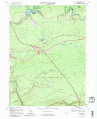
1992 Map of Hickory Run
USGS Topo · Published 1995About this map
The Lehigh River carves a deep path through Carbon County, forming the western boundary of this landscape dominated by conservation lands and the infrastructure of the Pennsylvania Turnpike Northeast Extension. The northern reach is anchored by the Francis E Walter Dam, while the central and southern portions are defined by the expansive Hickory Run State Park. Significant geologic interest is found at the Boulder Field and along the various ridges like Chestnut Ridge.
Find a feature on this map
57 named features on this map. Tap any name to fly to it.
Don’t see what you’re looking for? This feature index may not catch every label — zoom into the map to look around manually.
Map Details
Editions of this 1992 Hickory Run Map
This is the sole edition of this map. No revisions or reprints were ever made.
Other maps of this area

1889 · Hazleton
USGS Topo · 1:62,500

1891 · Wilkesbarre
USGS Topo · 1:62,500

1891 · Hazleton
USGS Topo · 1:62,500

1893 · Hazleton
USGS Topo · 1:62,500

1894 · Wilkesbarre
USGS Topo · 1:62,500

1922 · Mauch Chunk
USGS Topo · 1:62,500

1922 · Stoddartsville
USGS Topo · 1:62,500

1924 · Stoddartsville
USGS Topo · 1:62,500

1924 · Mauch Chunk
USGS Topo · 1:62,500

1943 · Scranton
USGS Topo · 1:125,000
Featured Places
- Kidder Township, PA
- Buck Township, PA
- Penn Forest Township, PA
- Tobyhanna Township, PA
- Saylorsville, Kidder Township