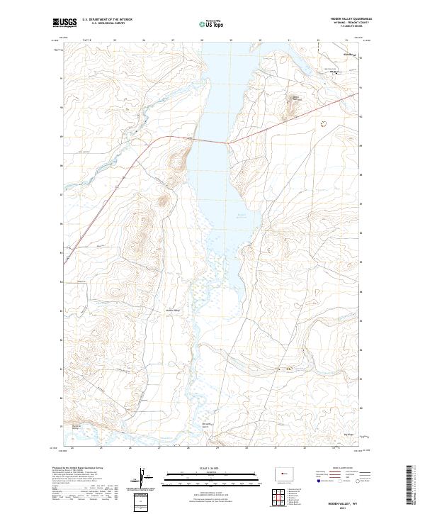
2021 Map of Hidden Valley
USGS Topo · Published 2021About this map
Boysen Reservoir dominates the central landscape of this Wyoming quadrangle, serving as a focal point for the region's complex water management system. The map details a network of irrigation and drainage essential to the area's agricultural history, including the Pilot Canal and numerous named drainages such as Fivemile Creek, Muskrat Creek, and Poison Cr. In the north, the town of Shoshoni sits near the Lake View Cem, while the namesake Hidden Valley and Riverton Valley are situated further south along the Wind River. The terrain is marked by distinctive geological features like Water Tank Hill, Horsethief Gulch, and Big Ridge. Local transportation is defined by a grid of rural roads, including Bass Lake Rd and N Hidden Valley Rd, reflecting the sparse but organized settlement pattern of Fremont County.
Find a feature on this map
28 named features on this map. Tap any name to fly to it.
Don’t see what you’re looking for? This feature index may not catch every label — zoom into the map to look around manually.
Map Details
Editions of this 2021 Hidden Valley Map
This is the sole edition of this map. No revisions or reprints were ever made.
Other maps of this area

1950 · Riverton East
USGS Topo · 1:24,000

1950 · Bonneville SW
USGS Topo · 1:24,000

1951 · Mexican Pass SE
USGS Topo · 1:24,000

1951 · Fuller Reservoir
USGS Topo · 1:24,000

1951 · Indian Butte
USGS Topo · 1:24,000

1951 · Hidden Valley
USGS Topo · 1:24,000

1951 · Bonneville
USGS Topo · 1:24,000

1951 · Shoshoni
USGS Topo · 1:24,000

1952 · Riverton NE
USGS Topo · 1:24,000

1955 · Thermopolis
USGS Topo · 1:250,000