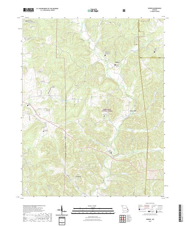
2021 Map of Higdon
USGS Topo · Published 2021About this map
The Saint Francois Mountains anchor the northwestern corner of this landscape, where the headwaters of the Upper Castor River and its numerous tributaries like Turkey Cr and Dry Br carve through the terrain. This rural expanse in Madison County is defined by its small, scattered settlements and a significant concentration of historical burial sites, suggesting a deeply rooted local genealogy. The community of Higdon serves as a central point, flanked by the Higdon Christian Cem and the Mount Gilead Methodist Episcopal Cem.
Find a feature on this map
64 named features on this map. Tap any name to fly to it.
Don’t see what you’re looking for? This feature index may not catch every label — zoom into the map to look around manually.
Map Details
Editions of this 2021 Higdon Map
This is the sole edition of this map. No revisions or reprints were ever made.
Other maps of this area

1910 · Higdon
USGS Topo · 1:62,500

1930 · Coldwater
USGS Topo · 1:62,500

1933 · Marquand
USGS Topo · 1:62,500

1938 · Marquand
USGS Topo · 1:62,500

1939 · Fredericktown
USGS Topo · 1:48,000

1947 · Fredericktown
USGS Topo · 1:62,500

1949 · Rolla
USGS Topo · 1:250,000

1949 · Coldwater
USGS Topo · 1:62,500

1950 · Fredericktown
USGS Topo · 1:62,500

1953 · Rolla
USGS Topo · 1:250,000