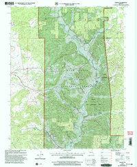
2000 Map of Higdon
USGS Topo · Published 2003About this map
Castor River meanders through the heart of this landscape, carving a valley where the Mark Twain National Forest meets private holdings in Madison County. This 2000 revision, based on topography from the mid-20th century, captures the rural network of the Higdon and Cornwall communities. The map highlights the localized nature of early 20th-century life through its distribution of neighborhood institutions, including the East Madison Sch and the Underwood Sch, alongside several small congregations such as Mt Gilead Ch and Spring Valley Ch.
Find a feature on this map
27 named features on this map. Tap any name to fly to it.
Don’t see what you’re looking for? This feature index may not catch every label — zoom into the map to look around manually.
Map Details
Editions of this 2000 Higdon Map
This is the sole edition of this map. No revisions or reprints were ever made.
Other maps of this area

1910 · Higdon
USGS Topo · 1:62,500

1930 · Coldwater
USGS Topo · 1:62,500

1933 · Marquand
USGS Topo · 1:62,500

1938 · Marquand
USGS Topo · 1:62,500

1939 · Fredericktown
USGS Topo · 1:48,000

1947 · Fredericktown
USGS Topo · 1:62,500

1949 · Rolla
USGS Topo · 1:250,000

1949 · Coldwater
USGS Topo · 1:62,500

1950 · Fredericktown
USGS Topo · 1:62,500

1953 · Rolla
USGS Topo · 1:250,000