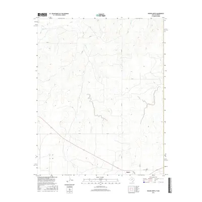
2016 Map of Higgins North
USGS Topo · Published 2016About this map
Higgins occupies the southern edge of this West Texas landscape, where the town's grid meets the branching drainage systems of the High Plains. The terrain is defined by a network of seasonal watercourses, including Wolf Cr and Canyon Cr in the north, and Long Creek to the south, which have carved distinct patterns into the elevation over time. This map serves as a detailed record of the rural road network, showing routes like Co RD T and Co RD 29 that connect isolated ranch lands.
Find a feature on this map
15 named features on this map. Tap any name to fly to it.
Don’t see what you’re looking for? This feature index may not catch every label — zoom into the map to look around manually.
Map Details
Editions of this 2016 Higgins North Map
This is the sole edition of this map. No revisions or reprints were ever made.
Other maps of this area

1954 · Perryton
USGS Topo · 1:250,000

1955 · Woodward
USGS Topo · 1:250,000

1958 · Perryton
USGS Topo · 1:250,000

1958 · Woodward
USGS Topo · 1:250,000
1969 · Shattuck
USGS Topo · 1:24,000
1970 · Arnett SW
USGS Topo · 1:24,000
1970 · Goodwin
USGS Topo · 1:24,000
1972 · Follett SE
USGS Topo · 1:24,000
1972 · Skunk Creek
USGS Topo · 1:24,000
1972 · Higgins North
USGS Topo · 1:24,000