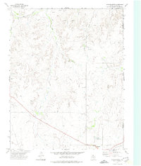
1972 Map of Higgins North
USGS Topo · Published 1974About this map
Higgins occupies the southern edge of this Panhandle landscape, where the A T & S F railroad cuts through the terrain near the Oklahoma state line. The survey captures an era of energy development and agricultural life, evidenced by numerous Gas Wells and an Oil Well scattered across the drainages of Wolf Creek and Camp Creek. A local Cem stands just outside the town limits, providing a key point of interest for genealogists tracing family roots in this corner of Lipscomb County.
Find a feature on this map
18 named features on this map. Tap any name to fly to it.
Don’t see what you’re looking for? This feature index may not catch every label — zoom into the map to look around manually.
Map Details
Editions of this 1972 Higgins North Map
This is the sole edition of this map. No revisions or reprints were ever made.
Other maps of this area

1954 · Perryton
USGS Topo · 1:250,000

1955 · Woodward
USGS Topo · 1:250,000

1958 · Perryton
USGS Topo · 1:250,000

1958 · Woodward
USGS Topo · 1:250,000

1969 · Shattuck
USGS Topo · 1:24,000
1970 · Arnett SW
USGS Topo · 1:24,000

1970 · Goodwin
USGS Topo · 1:24,000

1972 · Follett SE
USGS Topo · 1:24,000

1972 · Skunk Creek
USGS Topo · 1:24,000

1972 · Willow Creek
USGS Topo · 1:24,000