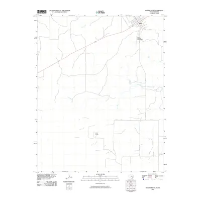
2010 Map of Higgins South
USGS Topo · Published 2010About this map
Higgins occupies the northeastern corner of this survey, positioned at a critical junction of transportation and commerce near the Texas-Oklahoma border. This 2010 depiction captures the modern infrastructure of the High Plains, where the aviation access provided by the Higgins-Lipscomb County Airport meets a grid of rural ranch roads including FM 1453 and Ranch RD 2758. The landscape is defined by the drainage basins of Commission Creek and Camp Creek, which cut through the open country.
Find a feature on this map
12 named features on this map. Tap any name to fly to it.
Don’t see what you’re looking for? This feature index may not catch every label — zoom into the map to look around manually.
Map Details
Editions of this 2010 Higgins South Map
This is the sole edition of this map. No revisions or reprints were ever made.
Other maps of this area

1954 · Perryton
USGS Topo · 1:250,000

1954 · Amarillo
USGS Topo · 1:250,000

1955 · Clinton
USGS Topo · 1:250,000

1955 · Woodward
USGS Topo · 1:250,000

1957 · Clinton
USGS Topo · 1:250,000

1958 · Perryton
USGS Topo · 1:250,000

1958 · Woodward
USGS Topo · 1:250,000

1958 · Amarillo
USGS Topo · 1:250,000

1966 · Antelope Hills
USGS Topo · 1:24,000
1970 · Arnett SW
USGS Topo · 1:24,000