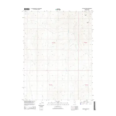
2014 Map of High Bald Peaks
USGS Topo · Published 2014About this map
The High Bald Peaks dominate the northeastern corner of this Elko County landscape, forming a prominent part of the Medicine Range. This high-altitude terrain in eastern Nevada is defined by a complex network of seasonal drainage channels that shape the arid environment. Significant watercourses such as Ruby Wash and Long Valley Wash carve through the topography, indicating the natural movement of water across this high desert expanse.
Find a feature on this map
11 named features on this map. Tap any name to fly to it.
Don’t see what you’re looking for? This feature index may not catch every label — zoom into the map to look around manually.
Map Details
Editions of this 2014 High Bald Peaks Map
This is the sole edition of this map. No revisions or reprints were ever made.
Other maps of this area

1955 · Elko
USGS Topo · 1:250,000

1958 · Elko
USGS Topo · 1:250,000

1962 · Elko
USGS Topo · 1:250,000

1965 · Elko
USGS Topo · 1:250,000
1968 · Franklin Lake SE
USGS Topo · 1:24,000
1968 · Ruby Lake SE
USGS Topo · 1:24,000
1968 · Ruby Lake NE
USGS Topo · 1:24,000
1984 · High Bald Peaks SE
USGS Topo · 1:24,000
1984 · High Bald Peaks
USGS Topo · 1:24,000
1984 · Medicine Spring
USGS Topo · 1:24,000