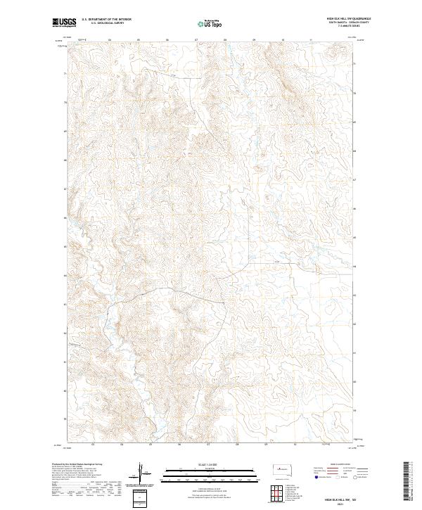
2021 Map of High Elk Hill SW
USGS Topo · Published 2021About this map
Cottonwood Creek and Dupree Creek snake through this section of Ziebach County, defining the drainage patterns of the western South Dakota plains. The landscape is characterized by its rural isolation, where the vast majority of the terrain is subdivided by the Public Land Survey System into townships such as t10n r22e. Human presence is marked primarily by sparse infrastructure like Sunnybrook Road and sections of County Road, which follow the natural contour and section lines of the prairie. This 2021 survey illustrates a region where water sources like the Cottonwood Creek system remain the most significant geographic landmarks for local land management and navigation in an otherwise open ranching environment.
Find a feature on this map
9 named features on this map. Tap any name to fly to it.
Don’t see what you’re looking for? This feature index may not catch every label — zoom into the map to look around manually.
Map Details
Editions of this 2021 High Elk Hill SW Map
This is the sole edition of this map. No revisions or reprints were ever made.
Other maps of this area

1954 · Pierre
USGS Topo · 1:250,000

1955 · Rattlesnake Lake NE
USGS Topo · 1:24,000

1956 · Cherry Creek NW
USGS Topo · 1:24,000

1956 · Carlin Flat
USGS Topo · 1:24,000

1958 · Pierre
USGS Topo · 1:250,000

1981 · High Elk Hill NW
USGS Topo · 1:24,000

1981 · High Elk Hill SE
USGS Topo · 1:24,000
1981 · High Elk Hill
USGS Topo · 1:24,000

1981 · High Elk Hill SW
USGS Topo · 1:24,000

1982 · Miller Dam
USGS Topo · 1:24,000