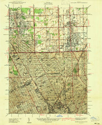
1940 Map of Highland Park
USGS Topo · Published 1940About this map
The dense urban expansion of northern Detroit and its surrounding enclaves is meticulously documented in this 1938 survey. This edition highlights the industrial and civic core of Highland Park and Hamtramck as they appeared just before the wartime production boom. Major landmarks such as the Michigan State Fair Grounds and the Detroit City Airport anchor the landscape, while the Detroit Terminal Railroad snakes through the grid, illustrating the era's heavy reliance on rail for logistics.
Find a feature on this map
128 named features on this map. Tap any name to fly to it.
Don’t see what you’re looking for? This feature index may not catch every label — zoom into the map to look around manually.
Map Details
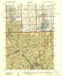
Editions of this 1940 Highland Park Map
2 editions found
Other maps of this area

1905 · Detroit
USGS Topo · 1:62,500

1905 · Grosse Pointe
USGS Topo · 1:62,500

1908 · Rochester
USGS Topo · 1:62,500

1912 · Mt Clemens
USGS Topo · 1:62,500

1918 · Detroit
USGS Topo · 1:62,500

1918 · Grosse Pointe
USGS Topo · 1:62,500

1924 · Detroit
USGS Topo · 1:62,500

1929 · Mt Clemens
USGS Topo · 1:62,500

1934 · Detroit
USGS Topo · 1:62,500

1936 · Warren
USGS Topo · 1:31,680