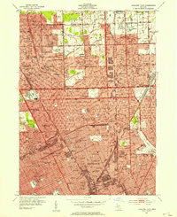
1952 Map of Highland Park
USGS Topo · Published 1954About this map
Detroit and its northern industrial neighbors thrive in this mid-century survey, showcasing the dense street grids and rail infrastructure of Highland Park and Hamtramck. The landscape is defined by its transit corridors, including the Grand Trunk Western RR and the Detroit Terminal RR, which fueled the regional manufacturing engine. Large green spaces like Palmer Park and the Detroit Golf Club provide a stark contrast to the tightly packed residential blocks and numerous neighborhood institutions.
Find a feature on this map
135 named features on this map. Tap any name to fly to it.
Don’t see what you’re looking for? This feature index may not catch every label — zoom into the map to look around manually.
Map Details
Editions of this 1952 Highland Park Map
2 editions found
Other maps of this area

1905 · Detroit
USGS Topo · 1:62,500

1905 · Grosse Pointe
USGS Topo · 1:62,500

1908 · Rochester
USGS Topo · 1:62,500

1912 · Mt Clemens
USGS Topo · 1:62,500

1918 · Detroit
USGS Topo · 1:62,500

1918 · Grosse Pointe
USGS Topo · 1:62,500

1924 · Detroit
USGS Topo · 1:62,500

1929 · Mt Clemens
USGS Topo · 1:62,500

1934 · Detroit
USGS Topo · 1:62,500

1936 · Warren
USGS Topo · 1:31,680