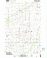
1997 Map of Highland Ranch
USGS Topo · Published 2002About this map
Highland Ranch and a network of family-held properties define this high-altitude landscape in Beaverhead County during the late 1990s. The area is characterized by vast drainage systems like Swamp Creek and Moose Creek, which flow through a terrain marked by numerous gravel operations. Local family names are deeply etched into the geography, with homesteads and points of interest such as Swanson Ranch, Rouse Ranch, and Barker. The map reveals a sparse but established rural infrastructure, anchored by Briston Lane and the Briston Cem. Water remains the lifeblood of the region, visible in the flow of Rock Creek toward Big Lake, illustrating the relationship between the drainage of the Big Hole basin and the ranching operations that have sustained these valleys for generations.
Find a feature on this map
27 named features on this map. Tap any name to fly to it.
Don’t see what you’re looking for? This feature index may not catch every label — zoom into the map to look around manually.
Map Details
Editions of this 1997 Highland Ranch Map
This is the sole edition of this map. No revisions or reprints were ever made.
Other maps of this area

1955 · Dillon
USGS Topo · 1:250,000

1957 · Dillon
USGS Topo · 1:250,000

1958 · Dillon
USGS Topo · 1:250,000

1962 · Dillon
USGS Topo · 1:250,000

1962 · Wisdom
USGS Topo · 1:24,000

1962 · Mud Lake
USGS Topo · 1:24,000

1965 · Dillon
USGS Topo · 1:250,000

1966 · Gibbons School
USGS Topo · 1:24,000

1966 · Big Hole Battlefield
USGS Topo · 1:24,000

1966 · Jumbo Mountain
USGS Topo · 1:24,000