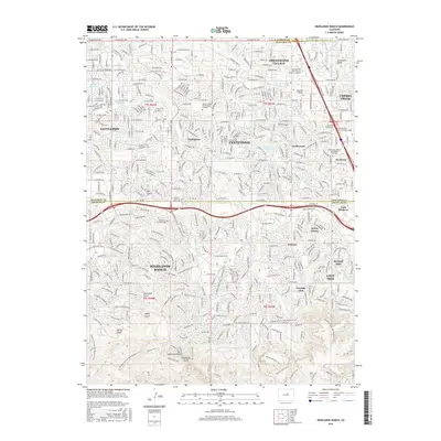
2016 Map of Highlands Ranch
USGS Topo · Published 2016About this map
Highlands Ranch and its neighboring residential corridors define this late-stage suburban landscape at the edge of the Denver metropolitan area. The map illustrates the sophisticated master-planned layout of the mid-2010s, characterized by winding residential streets, extensive greenbelts, and a dense network of recreational paths like the Douglas Co East/West Regional Trail and Wildcat Mountain Trail. This period shows a mature balance between high-density commercial hubs at Inverness and Southglenn and the protected natural drainages of Dad Clark Gulch and Marcy Gulch. Institutional growth is evident through the presence of specialized campuses such as the Augustine Institute and the Metropolitan State Univ of Denver S Campus. The historic management of water in this semi-arid region is still central to the geography, marked by the long-standing Highline Canal and the Englewood Reservoir.
Find a feature on this map
63 named features on this map. Tap any name to fly to it.
Don’t see what you’re looking for? This feature index may not catch every label — zoom into the map to look around manually.
Map Details
Editions of this 2016 Highlands Ranch Map
This is the sole edition of this map. No revisions or reprints were ever made.
Other maps of this area

1890 · East Denver
USGS Topo · 1:125,000

1893 · Platte Canyon
USGS Topo · 1:125,000

1894 · Castle Rock
USGS Topo · 1:125,000

1899 · West Denver
USGS Topo · 1:125,000

1913 · Castle Rock
USGS Topo · 1:125,000

1935 · East Denver Nos. 3 and 4
USGS Topo · 1:48,000

1940 · Englewood
USGS Topo · 1:31,680

1940 · Castle Rock
USGS Topo · 1:62,500

1941 · Fitzsimons
USGS Topo · 1:31,680

1941 · Fort Logan
USGS Topo · 1:31,680