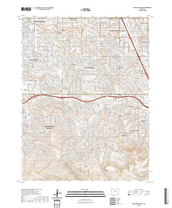
2022 Map of Highlands Ranch
USGS Topo · Published 2022About this map
Highlands Ranch and its neighboring residential communities define this suburban landscape south of Denver as it appeared in the early 2020s. The area is characterized by a dense network of modern subdivisions and carefully planned open spaces, including the prominent Shadow Mountain and the expansive Highlands Point. The map illustrates the sophisticated water management and recreation systems of the region, featuring the historic Highline Canal alongside modern trails like the Big Dry Creek Trl and Marcy Gulch.
Find a feature on this map
68 named features on this map. Tap any name to fly to it.
Don’t see what you’re looking for? This feature index may not catch every label — zoom into the map to look around manually.
Map Details
Editions of this 2022 Highlands Ranch Map
This is the sole edition of this map. No revisions or reprints were ever made.
Historical Maps of Acres Green Through Time
4 maps found