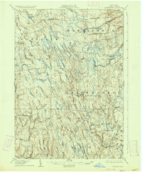
1906 Map of Highmarket
USGS Topo · Published 1934About this map
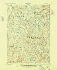
Michigan Mills and the surrounding Lewis County uplands are defined by a complex network of waterways that once fueled the region's early logging and milling industries. This 1906 survey captures the high plateau as the Glenfield and Western railroad branched into the timberlands of Martinsburg and Montague. Small hubs like Highmarket and Boyd are shown in their early 20th-century configuration, connected by primitive routes like Flatrock Road and French Road. The landscape is dominated by the sprawling headwaters of the Mad River, Salmon River, and East Branch Fish Creek, where numerous brooks—such as Swancott Mill Brook and Milligan Brook—signal a history of water-powered industry. Sparse settlements like Wetmore and North Osceola represent the isolated hamlets that supported the area's agricultural and forest-based economy before later consolidation.
Find a feature on this map
56 named features on this map. Tap any name to fly to it.
Don’t see what you’re looking for? This feature index may not catch every label — zoom into the map to look around manually.
Map Details
Editions of this 1906 Highmarket Map
6 editions found
Other maps of this area

1895 · Watertown
USGS Topo · 1:62,500

1898 · Watertown
USGS Topo · 1:62,500

1902 · Carthage
USGS Topo · 1:62,500

1903 · Orwell
USGS Topo · 1:62,500

1904 · Boonville
USGS Topo · 1:62,500

1904 · Carthage
USGS Topo · 1:62,500

1905 · Orwell
USGS Topo · 1:62,500

1905 · Port Leyden
USGS Topo · 1:62,500

1905 · Taberg
USGS Topo · 1:62,500

1906 · Highmarket
USGS Topo · 1:62,500