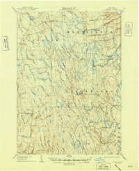
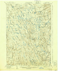
1906 Map of Highmarket
USGS Topo · Published 1948About this map
Michigan Mills and the timber-driven landscape of the Tug Hill Plateau define this early twentieth-century survey. The logging industry is physically etched into the terrain by the path of the Glenfield and Western RR, which winds through the townships of Montague, Martinsburg, and Highmarket. This industrial presence is contrasted by small, isolated settlements like Hooker, Page, and Highmarket, many of which served as focal points for the region's scattered agricultural and forestry communities.
Find a feature on this map
72 named features on this map. Tap any name to fly to it.
Don’t see what you’re looking for? This feature index may not catch every label — zoom into the map to look around manually.
Map Details
Editions of this 1906 Highmarket Map
6 editions found
Other maps of this area

1895 · Watertown
USGS Topo · 1:62,500

1898 · Watertown
USGS Topo · 1:62,500

1902 · Carthage
USGS Topo · 1:62,500

1903 · Orwell
USGS Topo · 1:62,500

1904 · Boonville
USGS Topo · 1:62,500

1904 · Carthage
USGS Topo · 1:62,500

1905 · Orwell
USGS Topo · 1:62,500

1905 · Port Leyden
USGS Topo · 1:62,500

1905 · Taberg
USGS Topo · 1:62,500

1906 · Highmarket
USGS Topo · 1:62,500