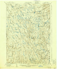
1906 Map of Highmarket
USGS Topo · Published 1939About this map
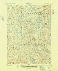
Highmarket and the surrounding Lewis County uplands are characterized by a dense network of headwater streams and remote industrial outposts in the early 1900s. The settlement of Michigan Mills stands as a focal point for the region’s timber and milling history, situated along the upper reaches of the North Branch Mad River. This landscape is defined by its radial drainage patterns, with numerous named waterways like Sevenmile Creek, Sixmile Creek, and Twomile Creek carving through the townships of Montague, Martinsburg, and Osceola. Small, isolated communities such as Boyd, Wetmore, and Parkers are connected by primitive routes like Flatrock Road and French Road. The mapping reveals a transition from the higher plateaus down toward the Salmon River in the southwest, capturing a moment when small-scale milling and upland farming dictated the placement of crossroads like Byron Cors.
Find a feature on this map
57 named features on this map. Tap any name to fly to it.
Don’t see what you’re looking for? This feature index may not catch every label — zoom into the map to look around manually.
Map Details
Editions of this 1906 Highmarket Map
6 editions found
Other maps of this area

1895 · Watertown
USGS Topo · 1:62,500

1898 · Watertown
USGS Topo · 1:62,500

1902 · Carthage
USGS Topo · 1:62,500

1903 · Orwell
USGS Topo · 1:62,500

1904 · Boonville
USGS Topo · 1:62,500

1904 · Carthage
USGS Topo · 1:62,500

1905 · Orwell
USGS Topo · 1:62,500

1905 · Port Leyden
USGS Topo · 1:62,500

1905 · Taberg
USGS Topo · 1:62,500

1906 · Highmarket
USGS Topo · 1:62,500