
1985 Map of Highmore
USGS Topo · Published 1986About this map
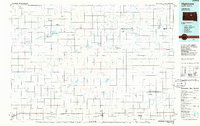
The Chicago and North Western corridor defines the southern landscape of this central South Dakota region, connecting the primary settlements of Highmore, Harrold, Holabird, and Blunt. This 1985 survey illustrates a vast agricultural and conservation landscape punctuated by numerous water bodies like Cottonwood Lake and Stone Lake, alongside designated lands such as the Lake Louise State Recreation Area.
Find a feature on this map
57 named features on this map. Tap any name to fly to it.
Don’t see what you’re looking for? This feature index may not catch every label — zoom into the map to look around manually.
Map Details
Editions of this 1985 Highmore Map
3 editions found
Other maps of this area

1899 · Northville
USGS Topo · 1:125,000

1899 · Redfield
USGS Topo · 1:125,000

1934 · Canning
USGS Topo · 1:48,000

1937 · Canning
USGS Topo · 1:62,500

1949 · Ree Heights NW
USGS Topo · 1:24,000

1949 · Mitchell Lake
USGS Topo · 1:24,000

1950 · Ree Heights SE
USGS Topo · 1:24,000

1950 · Highmore NE
USGS Topo · 1:24,000

1950 · Mitchell Lake
USGS Topo · 1:24,000

1950 · Highmore
USGS Topo · 1:24,000