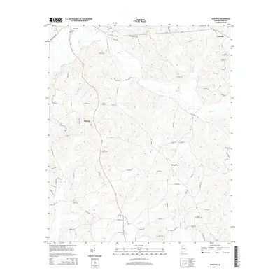
2014 Map of Hightogy
USGS Topo · Published 2014About this map
Vernon serves as a northern anchor for this landscape, where the confluence of several tributaries shapes the settlement patterns in Lamar County. The terrain is defined by the winding paths of Yellow Cr and the centrally located Hells Cr, around which several small communities and family-named roads are situated. This area is notably dense with small rural burial grounds, including the S Carolina Cem, Shiloh Cem, and Mt Zion Cem, suggesting a long-standing network of family farms and local parishes. Moving south along the Al-17 corridor, the map records the modest footprints of Hightogy and Kingville. These hamlets are connected by a web of local routes like Snake Branch Rd and Bethel Rd, which likely supported the agricultural and timber interests of the region. The map provides a look at the rural character of this Alabama hill country before modern large-scale development altered these historic property lines.
Find a feature on this map
89 named features on this map. Tap any name to fly to it.
Don’t see what you’re looking for? This feature index may not catch every label — zoom into the map to look around manually.
Map Details
Editions of this 2014 Hightogy Map
This is the sole edition of this map. No revisions or reprints were ever made.
Other maps of this area

1953 · Birmingham
USGS Topo · 1:250,000

1953 · West Point
USGS Topo · 1:250,000

1956 · Birmingham
USGS Topo · 1:250,000

1957 · Birmingham
USGS Topo · 1:250,000

1958 · West Point
USGS Topo · 1:250,000

1963 · West Point
USGS Topo · 1:250,000

1967 · Hightogy
USGS Topo · 1:24,000

1967 · Kennedy
USGS Topo · 1:24,000

1967 · Bluff
USGS Topo · 1:24,000

1967 · Millport
USGS Topo · 1:24,000