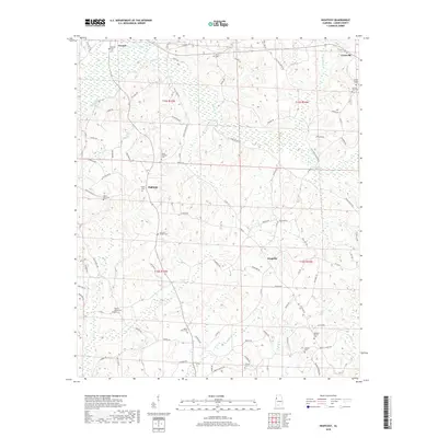
2018 Map of Hightogy
USGS Topo · Published 2018About this map
Vernon sits at the northern edge of this Lamar County landscape, where the terrain is defined by a dense network of creek valleys and ridges. Small rural centers such as Hightogy, Kingville, and Crossville are connected by a web of local roads including Co Rd 9 and Co Rd 22. The area is notably dense with small family and community burial grounds, which suggests a long-established pattern of dispersed upland settlement. Significant genealogically relevant sites include South Carolina Cem, Walnut Grove Cem, and Christian Chapel Cem. Drainage is provided by numerous named waterways like Hells Creek, Mud Creek, and Mill Creek, which carve out the distinct topography of the region. This 2018 survey reveals the persistent rural character of western Alabama, where historical road names like Old Landfill Rd and Liberty Church Rd reflect the local heritage and community landmarks.
Find a feature on this map
94 named features on this map. Tap any name to fly to it.
Don’t see what you’re looking for? This feature index may not catch every label — zoom into the map to look around manually.
Map Details
Editions of this 2018 Hightogy Map
This is the sole edition of this map. No revisions or reprints were ever made.
Other maps of this area
1953 · Birmingham
USGS Topo · 1:250,000
1953 · West Point
USGS Topo · 1:250,000
1956 · Birmingham
USGS Topo · 1:250,000
1957 · Birmingham
USGS Topo · 1:250,000
1958 · West Point
USGS Topo · 1:250,000
1963 · West Point
USGS Topo · 1:250,000
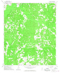
1967 · Hightogy
USGS Topo · 1:24,000
1967 · Kennedy
USGS Topo · 1:24,000
1967 · Bluff
USGS Topo · 1:24,000
1967 · Millport
USGS Topo · 1:24,000