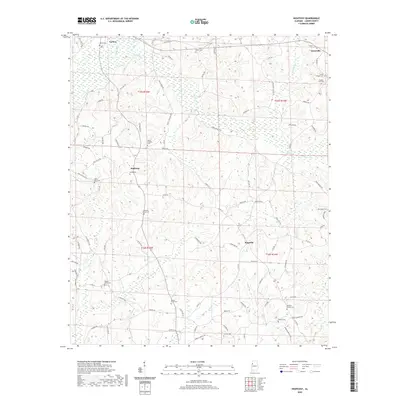
2020 Map of Hightogy
USGS Topo · Published 2020About this map
Vernon and the rural settlements of Hightogy and Kingville occupy a landscape defined by the intricate drainage networks of Yellow Creek and Hells Creek. This 2020 map documents the enduring character of Lamar County, where numerous family and community burial grounds, such as Meadow Branch Cem and Mount Olive Cem, are scattered throughout the countryside. The road network remains grounded in historical routes like Old Hwy 18 and Old Reform Rd, which connect these small hubs through the rolling terrain. The map's high density of cemeteries, including Shiloh Cem and Christian Chapel Cem, provides significant value for genealogists and local historians tracing the lineage of families in this corner of Alabama near the Mississippi border.
Find a feature on this map
97 named features on this map. Tap any name to fly to it.
Don’t see what you’re looking for? This feature index may not catch every label — zoom into the map to look around manually.
Map Details
Editions of this 2020 Hightogy Map
This is the sole edition of this map. No revisions or reprints were ever made.
Other maps of this area

1953 · Birmingham
USGS Topo · 1:250,000

1953 · West Point
USGS Topo · 1:250,000

1956 · Birmingham
USGS Topo · 1:250,000

1957 · Birmingham
USGS Topo · 1:250,000

1958 · West Point
USGS Topo · 1:250,000

1963 · West Point
USGS Topo · 1:250,000

1967 · Hightogy
USGS Topo · 1:24,000

1967 · Kennedy
USGS Topo · 1:24,000

1967 · Bluff
USGS Topo · 1:24,000

1967 · Millport
USGS Topo · 1:24,000