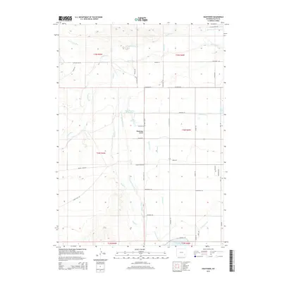
2015 Map of Hightower
USGS Topo · Published 2015About this map
Agricultural development and water management define this Wyoming landscape, where the Laramie River and Dry Laramie River meet a complex network of man-made irrigation infrastructure. The map reveals an intricate system of water distribution, including the Mullen Ditch, Number 2 Canal, and several laterals that sustain the high plains environment. Central to the area is the community of Westview Circle and the location of Hightower, situated near the confluence of Sybille Cr and the main river branch.
Find a feature on this map
45 named features on this map. Tap any name to fly to it.
Don’t see what you’re looking for? This feature index may not catch every label — zoom into the map to look around manually.
Map Details
Editions of this 2015 Hightower Map
This is the sole edition of this map. No revisions or reprints were ever made.
Other maps of this area

1896 · Hartville
USGS Topo · 1:125,000

1901 · Hartville
USGS Topo · 1:125,000

1951 · Dwyer
USGS Topo · 1:24,000
1951 · Wheatland
USGS Topo · 1:24,000

1953 · Lewis Flat
USGS Topo · 1:24,000

1953 · Hightower
USGS Topo · 1:24,000

1953 · Natwick
USGS Topo · 1:24,000

1953 · Squaw Rock
USGS Topo · 1:24,000

1953 · Ferguson Corner
USGS Topo · 1:24,000

1953 · Hightower SW
USGS Topo · 1:24,000