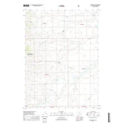
2018 Map of Hightower SW
USGS Topo · Published 2018About this map
The Laramie River and its seasonal tributaries define the landscape of this Platte County region, which is dominated by ranching infrastructure and forest reserves. The western edge is anchored by the Medicine Bow National Forest, while the rest of the terrain is a complex network of private and public land management focused on water rights. Numerous storage projects, including the Naffziger Reservoir, Bohke Reservoir, and Mertz Reservoir, point to the critical role of irrigation in this high-plains environment.
Find a feature on this map
37 named features on this map. Tap any name to fly to it.
Don’t see what you’re looking for? This feature index may not catch every label — zoom into the map to look around manually.
Map Details
Editions of this 2018 Hightower SW Map
This is the sole edition of this map. No revisions or reprints were ever made.
Other maps of this area
1953 · Lewis Flat
USGS Topo · 1:24,000
1953 · Hightower
USGS Topo · 1:24,000
1953 · Natwick
USGS Topo · 1:24,000
1953 · Squaw Rock
USGS Topo · 1:24,000
1953 · Hightower SW
USGS Topo · 1:24,000
1953 · Johnson Mountain
USGS Topo · 1:24,000
1954 · Torrington
USGS Topo · 1:250,000
1954 · Cheyenne
USGS Topo · 1:250,000
1955 · Moonshine Peak
USGS Topo · 1:24,000
1958 · Cheyenne
USGS Topo · 1:250,000