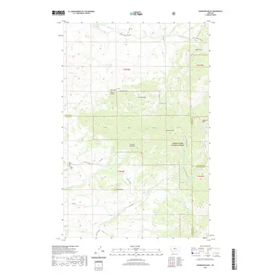
2020 Map of Highwood Baldy
USGS Topo · Published 2020About this map
Highwood Baldy stands as a prominent sentinel within the Highwood Mountains, where the boundaries of Cascade, Chouteau, and Judith Basin counties converge. This mountain landscape is defined by a series of deep drainages such as Wildcat Coulee and Grouse Coulee that feed into the larger creek systems. The high country is protected as part of the Lewis & Clark National Forest, which covers the central and eastern sections of the terrain, including summits like Pinewood Peak.
Find a feature on this map
44 named features on this map. Tap any name to fly to it.
Don’t see what you’re looking for? This feature index may not catch every label — zoom into the map to look around manually.
Map Details
Editions of this 2020 Highwood Baldy Map
This is the sole edition of this map. No revisions or reprints were ever made.
Other maps of this area

1890 · Fort Benton
USGS Topo · 1:250,000

1892 · Fort Benton
USGS Topo · 1:250,000

1897 · Fort Benton
USGS Topo · 1:250,000

1954 · Great Falls
USGS Topo · 1:250,000

1956 · Highwood
USGS Topo · 1:62,500

1956 · Belt
USGS Topo · 1:62,500

1957 · Great Falls
USGS Topo · 1:250,000
1975 · Belt SE
USGS Topo · 1:24,000
1975 · Belt NE
USGS Topo · 1:24,000

1978 · Arrow Peak
USGS Topo · 1:24,000