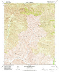
1964 Map of Hildreth Peak
USGS Topo · Published 1977About this map
Hildreth Peak rises as the central topographical landmark within the northern reaches of the Los Padres National Forest, overlooking a complex network of canyons and drainage systems. This mid-century survey documents a landscape defined by its thermal features and seasonal waterways, most notably Agua Caliente Spring and Little Caliente Spring. These natural springs, situated near the confluence of Agua Caliente Canyon and the Santa Ynez River, suggest the area's importance as a remote recreation and resource point.
Find a feature on this map
29 named features on this map. Tap any name to fly to it.
Don’t see what you’re looking for? This feature index may not catch every label — zoom into the map to look around manually.
Map Details
Editions of this 1964 Hildreth Peak Map
4 editions found
Other maps of this area

1902 · Santa Ynez
USGS Topo · 1:125,000

1903 · Mt. Pinos
USGS Topo · 1:125,000

1904 · Ventura
USGS Topo · 1:62,500

1905 · Santa Ynez
USGS Topo · 1:125,000

1941 · Ventura
USGS Topo · 1:62,500

1942 · Little Pine Mountain
USGS Topo · 1:24,000

1943 · Big Pine Mountain
USGS Topo · 1:31,680

1943 · Rancho Nuevo Creek
USGS Topo · 1:24,000

1943 · Old Man Mountain
USGS Topo · 1:24,000

1943 · Hildreth Peak
USGS Topo · 1:24,000