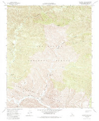
1964 Map of Hildreth Peak
USGS Topo · Published 1985About this map
Los Padres National Forest dominates this mid-1960s terrain, revealing a network of remote springs and backcountry outposts. The topographic detail highlights the winding course of the Santa Ynez River at the southern edge of the sheet, where several recreational sites including P-Bar Flats Campground and Pendola Campground are situated. The presence of the Pendola Guard Station and the Ogilvy Ranch illustrates the management and sparse private land use within the rugged public lands of the Los Prietos y Najalayegua land grant area.
Find a feature on this map
28 named features on this map. Tap any name to fly to it.
Don’t see what you’re looking for? This feature index may not catch every label — zoom into the map to look around manually.
Map Details
Editions of this 1964 Hildreth Peak Map
4 editions found
Other maps of this area

1902 · Santa Ynez
USGS Topo · 1:125,000

1903 · Mt. Pinos
USGS Topo · 1:125,000

1904 · Ventura
USGS Topo · 1:62,500

1905 · Santa Ynez
USGS Topo · 1:125,000

1941 · Ventura
USGS Topo · 1:62,500

1942 · Little Pine Mountain
USGS Topo · 1:24,000

1943 · Big Pine Mountain
USGS Topo · 1:31,680

1943 · Rancho Nuevo Creek
USGS Topo · 1:24,000

1943 · Old Man Mountain
USGS Topo · 1:24,000

1943 · Hildreth Peak
USGS Topo · 1:24,000