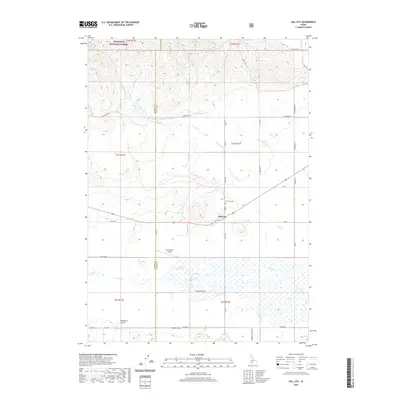
2020 Map of Hill City
USGS Topo · Published 2020About this map
The Camas Prairie provides the defining landscape of this region, where the flat, marshy lowlands of Camas Cr meet the rising foothills of the Sawtooth National Forest. The small settlement of Hill City serves as the central hub, situated near the intersection of Old Hwy 68 and Swamp Rd. This area has long been a intersection of ranching and aviation, evidenced by the Tracy Ranch Airport located just west of the county line. To the north, the terrain becomes increasingly complex with drainages like Munnice Cr and Cow Creek carving into the mountain slopes. Genealogists and local historians will find the Hill City Cem a significant landmark, while the surveyor's grid is marked by family-named routes such as Vodermeier Rd and Saunders Ln, reflecting the enduring agricultural footprint of Elmore and Camas counties.
Find a feature on this map
39 named features on this map. Tap any name to fly to it.
Don’t see what you’re looking for? This feature index may not catch every label — zoom into the map to look around manually.
Map Details
Editions of this 2020 Hill City Map
This is the sole edition of this map. No revisions or reprints were ever made.
Other maps of this area

1892 · Camas Prairie
USGS Topo · 1:125,000

1893 · Camas Prairie
USGS Topo · 1:125,000

1955 · Hailey
USGS Topo · 1:250,000

1957 · Fairfield
USGS Topo · 1:62,500

1957 · Davis Mountain
USGS Topo · 1:62,500

1958 · King Hill
USGS Topo · 1:62,500

1959 · Hailey
USGS Topo · 1:250,000

1962 · Hailey
USGS Topo · 1:250,000

1963 · High Prairie
USGS Topo · 1:24,000

1963 · Deer Mountain
USGS Topo · 1:24,000