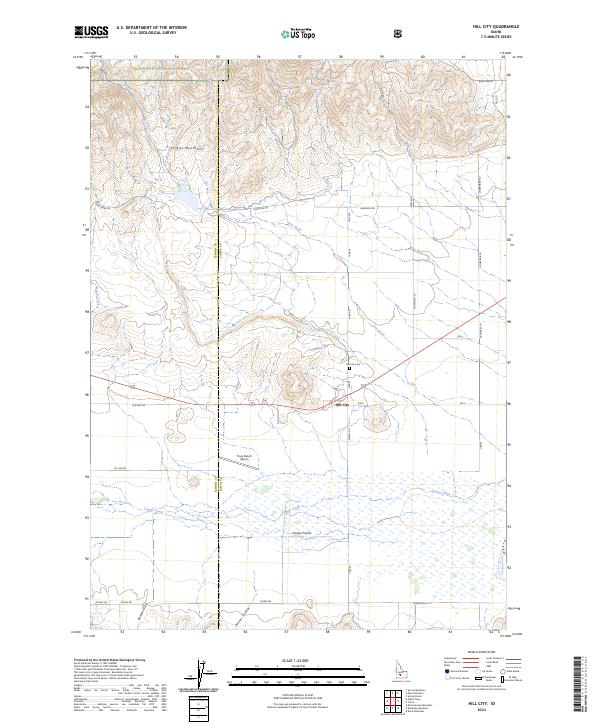
2024 Map of Hill City
USGS Topo · Published 2024About this map
Hill City sits at the northern edge of the wide Camas Prairie, serving as a focal point where the flat valley floor meets the rising foothills of the Soldier Mountains. The landscape transitions from the marshy lowlands of Camas Creek to the protected timberlands of the Sawtooth National Forest in the north. This survey illustrates a rural economy built around ranching and aviation, notably featuring the Tracy Ranch Airport south of the main settlement. A network of section-line roads, such as Harrison Rd and Stokes Rd, grids the prairie, while the Hill City Cem and various named drainages like Boyer Gulch and Cow Creek provide specific landmarks for local history and genealogical research. The boundary between Elmore and Camas counties runs north-to-south through the western portion of the quadrangle.
Find a feature on this map
38 named features on this map. Tap any name to fly to it.
Don’t see what you’re looking for? This feature index may not catch every label — zoom into the map to look around manually.
Map Details
Editions of this 2024 Hill City Map
This is the sole edition of this map. No revisions or reprints were ever made.
Other maps of this area

1892 · Camas Prairie
USGS Topo · 1:125,000

1893 · Camas Prairie
USGS Topo · 1:125,000

1955 · Hailey
USGS Topo · 1:250,000

1957 · Fairfield
USGS Topo · 1:62,500

1957 · Davis Mountain
USGS Topo · 1:62,500

1958 · King Hill
USGS Topo · 1:62,500

1959 · Hailey
USGS Topo · 1:250,000

1962 · Hailey
USGS Topo · 1:250,000

1963 · High Prairie
USGS Topo · 1:24,000

1963 · Deer Mountain
USGS Topo · 1:24,000