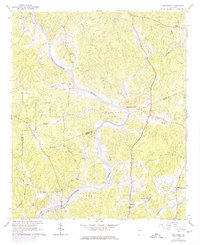
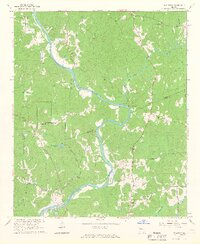
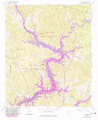
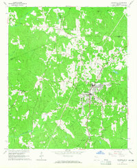
1964 Map of Hillcrest
USGS Topo · Published 1974About this map
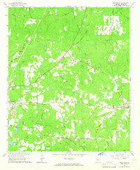
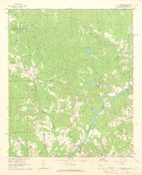
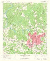
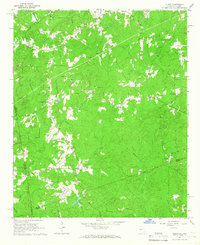
West Point Lake dominates this 1960s survey along the border of Heard and Troup counties, capturing a landscape in transition as the Chattahoochee River valley prepared for inundation. Purple hatching indicates the extensive areas destined to be submerged, including historical river crossings like Old Philpot Ferry. The settlement of Owensbyville and the community of Hillcrest, featuring a Sanitarium, sit among the ridges overlooking the shifting waterways of the New River and Potato Creek. Local heritage is preserved through numerous rural landmarks such as Mt Olive Ch, Harmony Ch, and the Harmony Cem. This map is a vital record for understanding the original topography and land use before the creation of the reservoir altered the terrain forever.
Find a feature on this map
31 named features on this map. Tap any name to fly to it.
Don’t see what you’re looking for? This feature index may not catch every label — zoom into the map to look around manually.
Map Details
Editions of this 1964 Hillcrest Map
3 editions found
Other maps of this area

1899 · Wedowee
USGS Topo · 1:125,000

1902 · Wedowee
USGS Topo · 1:125,000

1953 · Atlanta
USGS Topo · 1:250,000

1957 · Atlanta
USGS Topo · 1:250,000

1958 · Atlanta
USGS Topo · 1:250,000
1964 · Hogansville
USGS Topo · 1:24,000
1964 · Mountville
USGS Topo · 1:24,000
1964 · Abbottsford
USGS Topo · 1:24,000
1964 · La Grange
USGS Topo · 1:24,000
1964 · Glenn
USGS Topo · 1:24,000