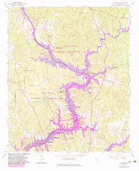
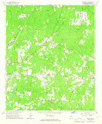
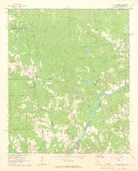
1964 Map of Hillcrest
USGS Topo · Published 1983About this map
The Chattahoochee River corridor transformed significantly during the early 1960s with the creation of West Point Lake, a landscape feature that dominates this Georgia terrain. The map documents the sprawling fingers of the reservoir as it pushed into the valleys of Brush Creek, Zachry Creek, and Yellowjacket Creek. While much of the riverbank is dedicated to the West Point Wildlife Management Area, small communities and institutional landmarks persist on the higher ground. The settlement of Owensbyville and the Hillcrest Sanitarium near Hillcrest serve as primary anchors for local history. Genealogists will find several rural congregations and burial sites preserved here, including Harmony Ch, Mt Olive Ch, and the Carver Chapel Cem near the northern boundary. The rise of the lake brought a network of new public spaces such as Chattahoochee Park and the Ringer Recreation Area, marking a shift toward a recreation-based economy.
Find a feature on this map
36 named features on this map. Tap any name to fly to it.
Don’t see what you’re looking for? This feature index may not catch every label — zoom into the map to look around manually.
Map Details
Editions of this 1964 Hillcrest Map
3 editions found
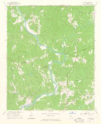
Other maps of this area

1899 · Wedowee
USGS Topo · 1:125,000

1902 · Wedowee
USGS Topo · 1:125,000

1953 · Atlanta
USGS Topo · 1:250,000

1957 · Atlanta
USGS Topo · 1:250,000

1958 · Atlanta
USGS Topo · 1:250,000
1964 · Hogansville
USGS Topo · 1:24,000
1964 · Mountville
USGS Topo · 1:24,000
1964 · Abbottsford
USGS Topo · 1:24,000
1964 · La Grange
USGS Topo · 1:24,000
1964 · Glenn
USGS Topo · 1:24,000