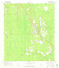
1970 Map of Hilliard
USGS Topo · Published 1973About this map
Hilliard and the surrounding Nassau County landscape are defined by a network of drainage and transportation in the early 1970s. The town centers on the Seaboard Coast Line railroad, which runs parallel to a corridor of utility and aviation features, including a Landing Strip, a Radio Tower, and a Lookout Tower. This layout reflects the local economic reliance on timber and rail transit during this era. Outside the main settlement, the terrain shifts into low-lying wetlands such as Buford Bay and Cabbage Swamp, which feed into Little St Marys River and Mills Creek. Local heritage is anchored by landmarks like Buford Grove Ch and the neighboring St Theresa Cem and Oakwood Cem, while the small settlement of Andrews marks the northern rail approach near a dedicated Weighing Sta.
Find a feature on this map
27 named features on this map. Tap any name to fly to it.
Don’t see what you’re looking for? This feature index may not catch every label — zoom into the map to look around manually.
Map Details
Editions of this 1970 Hilliard Map
2 editions found
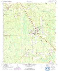
Other maps of this area

1917 · Boulogne
USGS Topo · 1:62,500

1917 · Hilliard
USGS Topo · 1:62,500

1918 · Folkston
USGS Topo · 1:62,500

1918 · Moniac
USGS Topo · 1:62,500

1919 · Hilliard
USGS Topo · 1:62,500

1919 · Boulogne
USGS Topo · 1:62,500

1942 · Moniac
USGS Topo · 1:62,500

1948 · Jacksonville
USGS Topo · 1:250,000

1954 · Valdosta
USGS Topo · 1:250,000

1957 · Jacksonville
USGS Topo · 1:250,000