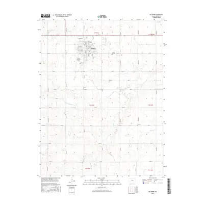
2015 Map of Hillsboro
USGS Topo · Published 2015About this map
Tabor Coll stands as a central landmark in Hillsboro, anchoring a landscape defined by organized grid-pattern agriculture and the winding drainage of the S Cottonwood River. The town's layout is meticulously detailed, showing the residential blocks and named streets like N Adams St and E 1st St that radiate from the campus. Rural cemetery placements, including Zion Cem to the north and the Gnadenau Cem further south, reflect the settlement patterns and community history of Marion County.
Find a feature on this map
67 named features on this map. Tap any name to fly to it.
Don’t see what you’re looking for? This feature index may not catch every label — zoom into the map to look around manually.
Map Details
Editions of this 2015 Hillsboro Map
This is the sole edition of this map. No revisions or reprints were ever made.
Other maps of this area

1889 · Newton
USGS Topo · 1:125,000

1894 · Newton
USGS Topo · 1:125,000

1955 · Hutchinson
USGS Topo · 1:250,000

1957 · Peabody NW
USGS Topo · 1:24,000

1957 · Peabody
USGS Topo · 1:24,000

1959 · Hutchinson
USGS Topo · 1:250,000

1965 · Goessel
USGS Topo · 1:24,000

1971 · Durham
USGS Topo · 1:24,000
1971 · Lehigh
USGS Topo · 1:24,000
1971 · Waldeck
USGS Topo · 1:24,000