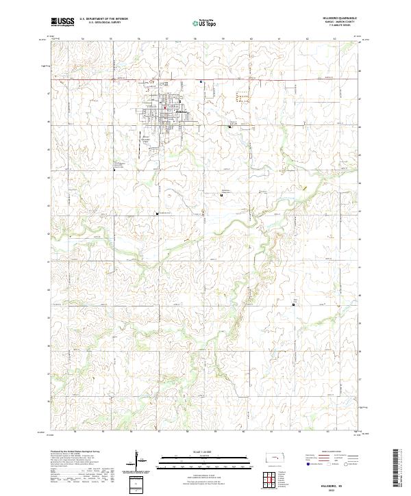
2022 Map of Hillsboro
USGS Topo · Published 2022About this map
Hillsboro serves as the focal point of this Marion County landscape, dominated by its grid of residential streets and the campus of Tabor College. The settlement pattern reveals the deep-rooted heritage of the region, specifically through its numerous religious and community burial grounds like the Alexanderfeld Mennonite Church Cem and the Gnadenau Village Cem. Beyond the town limits, the geography is defined by a strictly surveyed section-line road system, including routes like 13 Mile Rd and 200th St, which partition the agricultural terrain. This rural infrastructure is occasionally interrupted by the winding paths of the S Cottonwood River and Antelope Cr, which carve natural drainages across the townships. The proximity of several distinct cemeteries, such as Zion Cem and Gnadenau Cem, points to the early clustered settlements and immigrant communities that originally developed this portion of the Kansas prairie.
Find a feature on this map
67 named features on this map. Tap any name to fly to it.
Don’t see what you’re looking for? This feature index may not catch every label — zoom into the map to look around manually.
Map Details
Editions of this 2022 Hillsboro Map
This is the sole edition of this map. No revisions or reprints were ever made.
Other maps of this area

1889 · Newton
USGS Topo · 1:125,000

1894 · Newton
USGS Topo · 1:125,000

1955 · Hutchinson
USGS Topo · 1:250,000

1957 · Peabody NW
USGS Topo · 1:24,000

1957 · Peabody
USGS Topo · 1:24,000

1959 · Hutchinson
USGS Topo · 1:250,000

1965 · Goessel
USGS Topo · 1:24,000

1971 · Durham
USGS Topo · 1:24,000
1971 · Lehigh
USGS Topo · 1:24,000
1971 · Waldeck
USGS Topo · 1:24,000