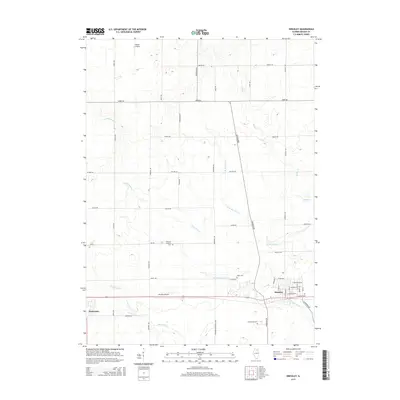
2015 Map of Hinckley
USGS Topo · Published 2015About this map
Hinckley and Waterman anchor this section of DeKalb County, where the agricultural grid is defined by a dense network of country roads and winding prairie streams. The landscape is marked by the drainages of Battle Cr, Somonauk Cr, and W Br Big Rock Cr, which cut through the level terrain. Local history is preserved in several rural burial grounds, including the Immanuel Lutheran Cem along Lee RD and the Miller Cem near Duffy RD. The region's connection to general aviation is evident through both the Hinckley Airport and Walter Airport. Notable thoroughfares like the Governor Beveridge Hwy and E Sandwich RD provide primary transit between these small Illinois settlements and the surrounding farmsteads.
Find a feature on this map
47 named features on this map. Tap any name to fly to it.
Don’t see what you’re looking for? This feature index may not catch every label — zoom into the map to look around manually.
Map Details
Editions of this 2015 Hinckley Map
This is the sole edition of this map. No revisions or reprints were ever made.
Other maps of this area

1934 · De Kalb
USGS Topo · 1:62,500

1937 · De Kalb
USGS Topo · 1:62,500

1937 · Sycamore
USGS Topo · 1:62,500

1948 · Sandwich
USGS Topo · 1:62,500

1950 · Sandwich
USGS Topo · 1:62,500

1951 · Earlville
USGS Topo · 1:62,500

1958 · Aurora
USGS Topo · 1:250,000

1961 · Aurora
USGS Topo · 1:250,000
1968 · Sycamore
USGS Topo · 1:24,000
1968 · Big Rock
USGS Topo · 1:24,000