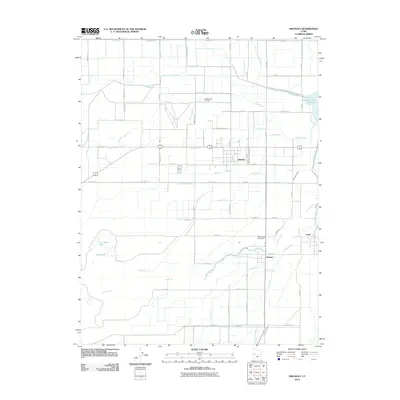
2010 Map of Hinckley
USGS Topo · Published 2010About this map
Hinckley and its neighboring agricultural settlements of Deseret and Oasis define this West-Central Utah landscape, shaped by an intricate network of irrigation engineering. The path of the Sevier River winds through the southern half of the map, diverted and managed by features like the Abraham Canal, Deseret Canal, and the South Hinckley Canal. This reliance on water rights is evident in the proliferation of named ditches such as Langston Ditch and Neeley Ditch, which extend into the surrounding grid of section lines.
Find a feature on this map
73 named features on this map. Tap any name to fly to it.
Don’t see what you’re looking for? This feature index may not catch every label — zoom into the map to look around manually.
Map Details
Editions of this 2010 Hinckley Map
This is the sole edition of this map. No revisions or reprints were ever made.
Other maps of this area

1885 · Sevier Desert
USGS Topo · 1:250,000

1953 · Delta
USGS Topo · 1:250,000

1958 · Delta
USGS Topo · 1:250,000

1962 · Delta
USGS Topo · 1:250,000

1962 · Delta
USGS Topo · 1:62,500

1971 · Smelter Knolls East
USGS Topo · 1:24,000

1971 · Pavant Butte North
USGS Topo · 1:24,000

1971 · Sunstone Knoll
USGS Topo · 1:24,000
1971 · Pot Mountain
USGS Topo · 1:24,000
1971 · Crafts Lake
USGS Topo · 1:24,000