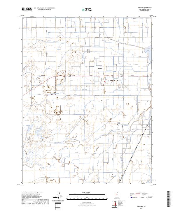
2023 Map of Hinckley
USGS Topo · Published 2023About this map
Irrigation infrastructure and water management define this portion of Millard County, where the Sevier River and its Old Channel navigate the desert floor near Gunnison Bend Reservoir. The settlement of Hinckley sits at the heart of an intricate web of man-made waterways, including the Abraham Canal, Highline Canal, and numerous family or district-named ditches like the Nielson Ditch and Neeley Ditch. These canals reflect a century-long effort to divert water from the Sevier to support the agricultural community.
Find a feature on this map
83 named features on this map. Tap any name to fly to it.
Don’t see what you’re looking for? This feature index may not catch every label — zoom into the map to look around manually.
Map Details
Editions of this 2023 Hinckley Map
This is the sole edition of this map. No revisions or reprints were ever made.
Other maps of this area

1885 · Sevier Desert
USGS Topo · 1:250,000

1953 · Delta
USGS Topo · 1:250,000

1958 · Delta
USGS Topo · 1:250,000

1962 · Delta
USGS Topo · 1:250,000

1962 · Delta
USGS Topo · 1:62,500

1971 · Smelter Knolls East
USGS Topo · 1:24,000

1971 · Pavant Butte North
USGS Topo · 1:24,000

1971 · Sunstone Knoll
USGS Topo · 1:24,000
1971 · Pot Mountain
USGS Topo · 1:24,000
1971 · Crafts Lake
USGS Topo · 1:24,000