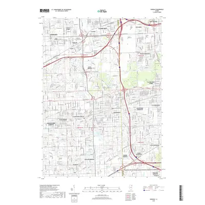
2018 Map of Hinsdale
USGS Topo · Published 2018About this map
Hinsdale, Clarendon Hills, and Westmont anchor the center of this suburban landscape as it appeared in the late 2010s. The map illustrates a dense network of residential streets and arterial roads like Ogden Ave and Butterfield Rd, which connect established villages with newer corporate and educational centers such as Olivet Nazarene Univ and the Lewis Univ - Oak Brook Campus. Large-scale land use is dominated by extensive cemetery grounds, including the sprawling Mount Carmel Cem and Queen of Heaven Cem in the northeast.
Find a feature on this map
104 named features on this map. Tap any name to fly to it.
Don’t see what you’re looking for? This feature index may not catch every label — zoom into the map to look around manually.
Map Details
Editions of this 2018 Hinsdale Map
This is the sole edition of this map. No revisions or reprints were ever made.
Other maps of this area

1890 · Des Plaines
USGS Topo · 1:62,500

1891 · Riverside
USGS Topo · 1:62,500

1892 · Joliet
USGS Topo · 1:62,500

1893 · Riverside
USGS Topo · 1:62,500

1894 · Des Plaines
USGS Topo · 1:62,500

1900 · Des Plaines
USGS Topo · 1:62,500

1900 · Riverside
USGS Topo · 1:62,500

1901 · Des Plaines
USGS Topo · 1:62,500

1901 · Riverside
USGS Topo · 1:62,500

1908 · Wheaton
USGS Topo · 1:62,500