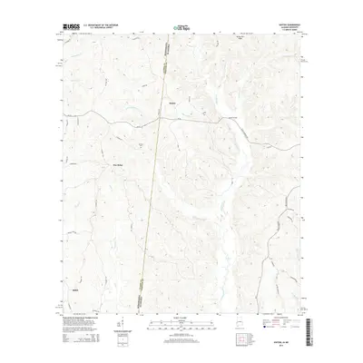
2014 Map of Hinton
USGS Topo · Published 2014About this map
Hinton and the surrounding borderlands of Alabama and Mississippi are defined by a complex drainage network that flows through the woodlands of Choctaw County. The terrain is shaped by the presence of Okatuppa Creek and its many tributaries, including Little Okatuppa Cr and Rattlesnake Cr, which dictate the placement of local thoroughfares. Small rural hubs like Pine Ridge and Shiloh are connected by a web of county roads and historic crossings such as Haney Bridge. The high ground of Turkey Pen Ridge rises above the creek beds, providing a clear view of the topographical transition across the state line. Genealogists and local historians can use the placement of Antioch Cem and family-named features like Carmichael Cr to pinpoint ancestral locations in this quiet corner of the South.
Find a feature on this map
51 named features on this map. Tap any name to fly to it.
Don’t see what you’re looking for? This feature index may not catch every label — zoom into the map to look around manually.
Map Details
Editions of this 2014 Hinton Map
This is the sole edition of this map. No revisions or reprints were ever made.
Other maps of this area

1953 · Hattiesburg
USGS Topo · 1:250,000

1953 · Meridian
USGS Topo · 1:250,000

1957 · Meridian
USGS Topo · 1:250,000

1957 · Quitman
USGS Topo · 1:62,500

1958 · Hattiesburg
USGS Topo · 1:250,000

1964 · Carmichael
USGS Topo · 1:24,000

1965 · Meridian
USGS Topo · 1:250,000

1974 · Melvin
USGS Topo · 1:24,000
1974 · Toxey
USGS Topo · 1:24,000

1974 · Yantley
USGS Topo · 1:24,000