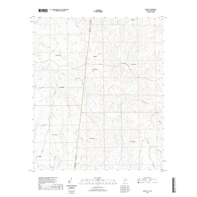
2020 Map of Hinton
USGS Topo · Published 2020About this map
Hinton sits at the center of this rural landscape, positioned where the Mississippi-Alabama state line bisects the deep creek valleys and ridgelines of the Piney Woods. The topography is dominated by the sprawling drainage system of Okatuppa Creek and its many tributaries, including Little Okatuppa Creek and Harvey Branch. Local transportation and community life are grounded along the winding paths of Hinton Road and County Road 20, which crosses the water at Haney Bridge.
Find a feature on this map
56 named features on this map. Tap any name to fly to it.
Don’t see what you’re looking for? This feature index may not catch every label — zoom into the map to look around manually.
Map Details
Editions of this 2020 Hinton Map
This is the sole edition of this map. No revisions or reprints were ever made.
Other maps of this area

1953 · Hattiesburg
USGS Topo · 1:250,000

1953 · Meridian
USGS Topo · 1:250,000

1957 · Meridian
USGS Topo · 1:250,000

1957 · Quitman
USGS Topo · 1:62,500

1958 · Hattiesburg
USGS Topo · 1:250,000

1964 · Carmichael
USGS Topo · 1:24,000

1965 · Meridian
USGS Topo · 1:250,000

1974 · Melvin
USGS Topo · 1:24,000
1974 · Toxey
USGS Topo · 1:24,000

1974 · Yantley
USGS Topo · 1:24,000