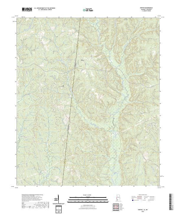
2024 Map of Hinton
USGS Topo · Published 2024About this map
The borderlands of Choctaw County, Alabama, and Clarke County, Mississippi, are defined by the winding drainages of Little Okatuppa Creek and its many tributaries. This 2024 survey captures the rural character of the Hinton community, situated where the terrain begins its ascent toward Turkey Pen Ridge. The landscape is etched with a network of county roads and local routes like Crest Rd and Faith Rd, which provide access to family sites and landmarks like Antioch Cem. The hydrography of the region is notably dense, with systems such as Carmichael Creek, Cane Creek, and Harvey Branch feeding into the larger river basins. Historical boundaries are meticulously preserved on this sheet, illustrating the exact intersection of the state line and county limits near Short Forks and Cedar Creek.
Find a feature on this map
51 named features on this map. Tap any name to fly to it.
Don’t see what you’re looking for? This feature index may not catch every label — zoom into the map to look around manually.
Map Details
Editions of this 2024 Hinton Map
This is the sole edition of this map. No revisions or reprints were ever made.
Other maps of this area

1953 · Hattiesburg
USGS Topo · 1:250,000

1953 · Meridian
USGS Topo · 1:250,000

1957 · Meridian
USGS Topo · 1:250,000

1957 · Quitman
USGS Topo · 1:62,500

1958 · Hattiesburg
USGS Topo · 1:250,000

1964 · Carmichael
USGS Topo · 1:24,000

1965 · Meridian
USGS Topo · 1:250,000

1974 · Melvin
USGS Topo · 1:24,000
1974 · Toxey
USGS Topo · 1:24,000

1974 · Yantley
USGS Topo · 1:24,000