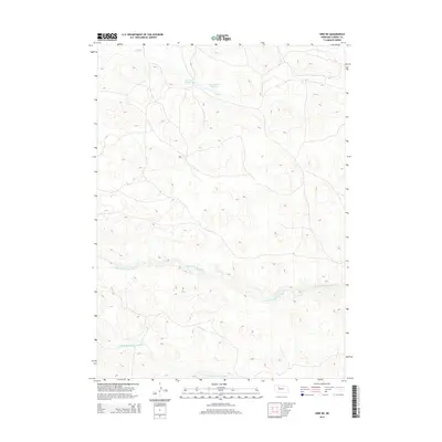
2014 Map of Hire NE
USGS Topo · Published 2014About this map
The Sandhills of Cherry County dominate this landscape, where the shifting drainage patterns of the Loup River system define the local geography. The N Br Middle Loup River and Middle Br Middle Loup River cut prominent paths through the undulating terrain, illustrating the hydrologic character of this Nebraska cattle country. Human impact is sparse but strategic, represented by water management features like Cox Reservoir Number 1 and Cox Dam Number 2, which are critical for supporting agriculture and livestock in an otherwise arid environment. Along the northern edge, Calf Cr provides another vital water source within this vast network of dunes and prairie grasses.
Find a feature on this map
5 named features on this map. Tap any name to fly to it.
Don’t see what you’re looking for? This feature index may not catch every label — zoom into the map to look around manually.
Map Details
Editions of this 2014 Hire NE Map
This is the sole edition of this map. No revisions or reprints were ever made.
Other maps of this area

1948 · Mullen
USGS Topo · 1:62,500

1949 · Big Falls
USGS Topo · 1:62,500

1950 · Hire
USGS Topo · 1:62,500

1950 · Wolf Lake
USGS Topo · 1:62,500

1951 · Mullen
USGS Topo · 1:62,500

1951 · Big Falls
USGS Topo · 1:62,500

1951 · Wolf Lake
USGS Topo · 1:62,500

1957 · Valentine
USGS Topo · 1:250,000

1959 · Valentine
USGS Topo · 1:250,000

1985 · Mullen
USGS Topo · 1:100,000