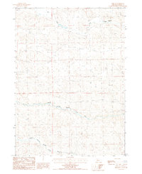
1987 Map of Hire NE
USGS Topo · Published 1987About this map
W. D. Phipps Ranch stands as the primary namesake landmark in this remote corner of the Sandhills during the mid-1980s. The landscape is defined by its subtle drainage patterns, featuring the North Branch and the Middle Branch Middle Loup River, which wind through the township boundaries of T26N and T25N. In the northern portion of the quadrangle, Calf Creek flows eastward, cutting through a terrain characterized by extensive sand dunes and occasional ranching infrastructure. This provisional survey captures a sparsely populated region where the orientation of fences, unimproved roads, and windmills reflects the logistical demands of cattle ranching in the Nebraska interior. The map provides a detailed record of the land use and hydrology before modern center-pivot irrigation or further development significantly altered the traditional ranching corridors.
Find a feature on this map
6 named features on this map. Tap any name to fly to it.
Don’t see what you’re looking for? This feature index may not catch every label — zoom into the map to look around manually.
Map Details
Editions of this 1987 Hire NE Map
This is the sole edition of this map. No revisions or reprints were ever made.
Other maps of this area

1948 · Mullen
USGS Topo · 1:62,500

1949 · Big Falls
USGS Topo · 1:62,500

1950 · Hire
USGS Topo · 1:62,500

1950 · Wolf Lake
USGS Topo · 1:62,500

1951 · Mullen
USGS Topo · 1:62,500

1951 · Big Falls
USGS Topo · 1:62,500

1951 · Wolf Lake
USGS Topo · 1:62,500

1957 · Valentine
USGS Topo · 1:250,000

1959 · Valentine
USGS Topo · 1:250,000

1985 · Mullen
USGS Topo · 1:100,000