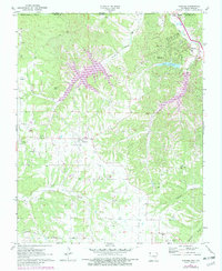
1971 Map of Hiwasse
USGS Topo · Published 1982About this map
Bella Vista and the community of Hiwasse anchor this 1970s landscape in Northwest Arkansas, where the development of recreational water features was rapidly reshaping the rural terrain. The map records the expansion of Loch Lomond, Lake Avalon, and Lake Windsor along the winding course of Tanyard Creek. These artificial lakes contrast with the older, established landmarks of the area, including numerous country churches such as Mr Pleasant Ch and Blackjack Ch.
Find a feature on this map
32 named features on this map. Tap any name to fly to it.
Don’t see what you’re looking for? This feature index may not catch every label — zoom into the map to look around manually.
Map Details
Editions of this 1971 Hiwasse Map
3 editions found
Other maps of this area

1899 · Fayetteville
USGS Topo · 1:125,000

1901 · Fayetteville
USGS Topo · 1:125,000

1904 · Fayetteville
USGS Topo · 1:125,000

1940 · Noel
USGS Topo · 1:62,500

1941 · Rocky Comfort
USGS Topo · 1:62,500

1943 · Noel
USGS Topo · 1:62,500

1943 · Rocky Comfort
USGS Topo · 1:62,500

1954 · Tulsa
USGS Topo · 1:250,000

1958 · Tulsa
USGS Topo · 1:250,000

1963 · Tulsa
USGS Topo · 1:250,000