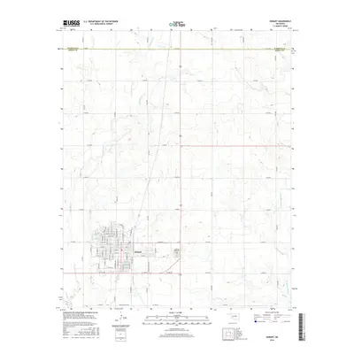
2016 Map of Hobart
USGS Topo · Published 2016About this map
Hobart serves as the focal point of this southwestern Oklahoma landscape, positioned just south of the Washita Co Kiowa Co line. The town's grid is well-defined by a network of residential and commercial streets, including E Iris Ave and W Cherry St, while the Hobart Rose Cem sits on the eastern edge of the community. This area reflects a classic Great Plains agricultural and water management pattern, where the town's proximity to Hunter Lake and the drainage of Little Elk Cr supports local infrastructure. To the east, the terrain is shaped by the winding path of Rainy Mountain Cr, illustrating the relationship between the prairie hydrology and the rural section-line road system that organizes the surrounding Kiowa County countryside.
Find a feature on this map
69 named features on this map. Tap any name to fly to it.
Don’t see what you’re looking for? This feature index may not catch every label — zoom into the map to look around manually.
Map Details
Editions of this 2016 Hobart Map
This is the sole edition of this map. No revisions or reprints were ever made.
Other maps of this area

1949 · Cooperton
USGS Topo · 1:62,500

1955 · Lawton
USGS Topo · 1:250,000

1955 · Clinton
USGS Topo · 1:250,000

1956 · Rainy Mountain Creek
USGS Topo · 1:24,000

1956 · Cooperton
USGS Topo · 1:62,500

1957 · Clinton
USGS Topo · 1:250,000

1961 · Gotebo
USGS Topo · 1:62,500

1961 · Hobart
USGS Topo · 1:62,500

1963 · Babbs
USGS Topo · 1:24,000

1964 · Lone Wolf
USGS Topo · 1:24,000