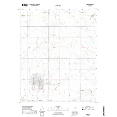
2018 Map of Hobart
USGS Topo · Published 2018About this map
Hobart serves as the primary hub of this landscape, situated just south of the boundary between Washita and Kiowa Counties. The town's organized grid is centered around the intersection of West 1st Street and South Main Street, with the municipal footprint extending toward Hunter Lake to the northwest. Outside the residential blocks, the landscape is defined by the drainage of Little Elk Creek and Rainy Mountain Creek, which cut through a network of section-line roads. Notable landmarks for genealogical research include the Hobart Rose Cemetery located east of the town center. The map captures a moment in the 21st century where the traditional rural township and range structure—indicated by markers like t7n r18w—remains the backbone of the region's geographic organization.
Find a feature on this map
75 named features on this map. Tap any name to fly to it.
Don’t see what you’re looking for? This feature index may not catch every label — zoom into the map to look around manually.
Map Details
Editions of this 2018 Hobart Map
This is the sole edition of this map. No revisions or reprints were ever made.
Other maps of this area

1949 · Cooperton
USGS Topo · 1:62,500

1955 · Lawton
USGS Topo · 1:250,000

1955 · Clinton
USGS Topo · 1:250,000

1956 · Rainy Mountain Creek
USGS Topo · 1:24,000

1956 · Cooperton
USGS Topo · 1:62,500

1957 · Clinton
USGS Topo · 1:250,000

1961 · Gotebo
USGS Topo · 1:62,500

1961 · Hobart
USGS Topo · 1:62,500

1963 · Babbs
USGS Topo · 1:24,000

1964 · Lone Wolf
USGS Topo · 1:24,000