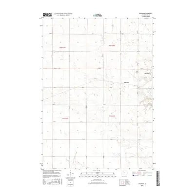
2015 Map of Hobarton
USGS Topo · Published 2015About this map
The small unincorporated community of Hobarton sits at the heart of this North Central Iowa agricultural landscape, positioned just west of the expanding edge of Algona. This 2015 survey illustrates a quintessential Midwestern grid system, where section lines are defined by a network of gravel and paved roads such as 220th St and 100th Ave. The terrain is characterized by the subtle drainage of Fourmile Cr and Hine Cr, which cut through the productive prairie farmland.
Find a feature on this map
29 named features on this map. Tap any name to fly to it.
Don’t see what you’re looking for? This feature index may not catch every label — zoom into the map to look around manually.
Map Details
Editions of this 2015 Hobarton Map
This is the sole edition of this map. No revisions or reprints were ever made.
Other maps of this area

1954 · Fairmont
USGS Topo · 1:250,000

1954 · Fort Dodge
USGS Topo · 1:250,000

1957 · Fort Dodge
USGS Topo · 1:250,000

1958 · Fort Dodge
USGS Topo · 1:250,000

1958 · Fairmont
USGS Topo · 1:250,000

1972 · Algona
USGS Topo · 1:24,000

1972 · St. Joseph
USGS Topo · 1:24,000

1972 · Burt
USGS Topo · 1:24,000

1980 · Lone Rock
USGS Topo · 1:24,000

1980 · Fenton
USGS Topo · 1:24,000