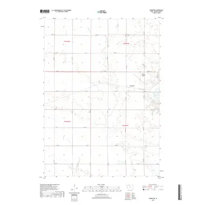
2018 Map of Hobarton
USGS Topo · Published 2018About this map
The settlement of Hobarton sits at the heart of this North Central Iowa landscape, situated just west of the East Fork Des Moines River. The terrain is defined by a dense grid of section-line roads and several local waterways, including Fourmile Cr in the north and Hine Cr to the south. This 2018 survey by the U.S. Geological Survey illustrates a contemporary agricultural and infrastructure pattern, notably featuring the Algona Municipal Airport and a network of county routes such as Co Hwy B55 and Country Club Rd. The map provides a precise look at the township divisions of T96N and T95N, showing how modern transportation corridors like Orton Rd integrate with the natural drainage basins of Kossuth County.
Find a feature on this map
29 named features on this map. Tap any name to fly to it.
Don’t see what you’re looking for? This feature index may not catch every label — zoom into the map to look around manually.
Map Details
Editions of this 2018 Hobarton Map
This is the sole edition of this map. No revisions or reprints were ever made.
Other maps of this area

1954 · Fairmont
USGS Topo · 1:250,000

1954 · Fort Dodge
USGS Topo · 1:250,000

1957 · Fort Dodge
USGS Topo · 1:250,000

1958 · Fort Dodge
USGS Topo · 1:250,000

1958 · Fairmont
USGS Topo · 1:250,000

1972 · Algona
USGS Topo · 1:24,000

1972 · St. Joseph
USGS Topo · 1:24,000

1972 · Burt
USGS Topo · 1:24,000

1980 · Lone Rock
USGS Topo · 1:24,000

1980 · Fenton
USGS Topo · 1:24,000