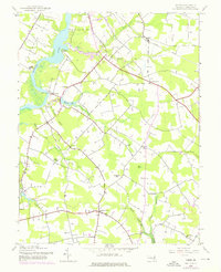
1944 Map of Hobbs
USGS Topo · Published 1976About this map
The Choptank River defines the western edge of this agricultural landscape in Caroline County, where early Maryland river transport and rural commerce left a distinct footprint. Water access was vital, evidenced by established points like Potters Landing, Lyford Landing, and Pealiquor Landing. Inland, the map reveals a network of small crossroads communities and rural nodes such as Andersontown, Concord, and the oddly named Two Johns. The spiritual life of the region is mapped through numerous houses of worship, including Williston Ch, St Pauls Ch, and Todds Chapel. While the Railroad Grade near Hobbs suggests a shift in transportation, the landscape remains dominated by drainage branches like Gravelly Branch and Wolfpit Branch that feed the river system. A mid-century addition, the Drive-in Theater near Watts Creek, reflects the evolving social habits of the post-war era alongside long-standing landmarks like Opossum Hill.
Find a feature on this map
32 named features on this map. Tap any name to fly to it.
Don’t see what you’re looking for? This feature index may not catch every label — zoom into the map to look around manually.
Map Details
Editions of this 1944 Hobbs Map
3 editions found
Other maps of this area

1905 · Denton
USGS Topo · 1:62,500

1905 · Hurlock
USGS Topo · 1:62,500

1915 · Seaford
USGS Topo · 1:62,500

1918 · Harrington
USGS Topo · 1:62,500

1944 · Denton
USGS Topo · 1:31,680
1944 · Preston
USGS Topo · 1:31,680

1944 · Federalsburg
USGS Topo · 1:31,680
1944 · Ridgely
USGS Topo · 1:31,680

1944 · Seaford
USGS Topo · 1:62,500

1944 · Hobbs
USGS Topo · 1:31,680