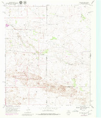
1969 Map of Hobbs SE
USGS Topo · Published 1980About this map
Monument Draw carves a subtle path across this arid landscape, straddling the state line where New Mexico and Texas meet. The terrain is defined by the industrial development of the late 1960s, marked by a dense network of pipelines and numerous oil wells that punctuate the plains. Near the northern boundary, the small settlement of Nadine sits adjacent to active resource extraction, including several gravel pits. Further south, the Kornegay Ranch represents the region's enduring ranching heritage amidst the growing energy infrastructure. This map, updated with 1979 aerial revisions, documents a specialized landscape where the borders of Lea, Gaines, and Andrews counties converge in a high-plains environment of drill holes and survey markers.
Find a feature on this map
12 named features on this map. Tap any name to fly to it.
Don’t see what you’re looking for? This feature index may not catch every label — zoom into the map to look around manually.
Map Details
Editions of this 1969 Hobbs SE Map
2 editions found
Other maps of this area

1954 · Hobbs
USGS Topo · 1:250,000

1958 · Hobbs
USGS Topo · 1:250,000

1969 · Hobbs SW
USGS Topo · 1:24,000

1969 · Hobbs East
USGS Topo · 1:24,000

1969 · Eunice
USGS Topo · 1:24,000

1969 · Hobbs SE
USGS Topo · 1:24,000

1969 · Eunice NE
USGS Topo · 1:24,000

1969 · Hobbs West
USGS Topo · 1:24,000

1971 · Brinson Ranch
USGS Topo · 1:24,000

1971 · Jumbo Hill
USGS Topo · 1:24,000